Travel update Adam’s Bridge: boat trips to the sandbanks from Talaimannar Checked 5 October 2026
A tourist boat service from Talaimannar to the Sri Lankan sandbanks of Adam’s Bridge went into operation on 28 September 2026, according to the Sunday Times, organised with the Mannar District Secretariat and the Northern Province Tourism Bureau. The operator, fares, sailing times and whether foreign visitors may go have not been published officially. Ask the Northern Province Tourism Bureau before you travel.
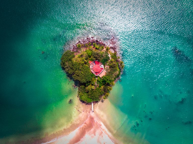
Adam’s Bridge, also called Rama’s Bridge or Rama Setu, is the chain of sandbanks and limestone shoals that runs out from the north-western tip of Mannar Island towards Pamban (Rameswaram) Island in India. The Sri Lankan half has been a marine national park since 2015, and the maritime border between the two countries runs through the middle of it. You can look out over it from the shore at Talaimannar, or go out to the sandbanks by boat when trips are running.
Is it worth visiting?
Go if the idea of standing on a bare sandbank in the open sea, halfway between two countries, appeals to you, and you are happy to travel to the far end of Mannar Island and get wet on the boat ride for a place that is, in the end, sand, sea and birds.
Think twice if you expect to see a “bridge” from the beach, because from the Talaimannar shore the sandbanks are low and a long way out, and boat trips depend on the sea and on official clearance, so you may get no further than the shoreline.
What Adam’s Bridge actually is
There is no bridge to walk across. What you find is a line of shoals and sandbanks between the Gulf of Mannar to the south and the Palk Strait to the north. Geological evidence suggests it was once a land connection between India and Sri Lanka, and the sea between the banks is still very shallow, between about 1 and 10 metres deep. A widely repeated account says the chain could be crossed on foot until the 15th century, and that temple records in India describe it standing above the sea until a cyclone in 1480. Treat that as tradition rather than proven history.
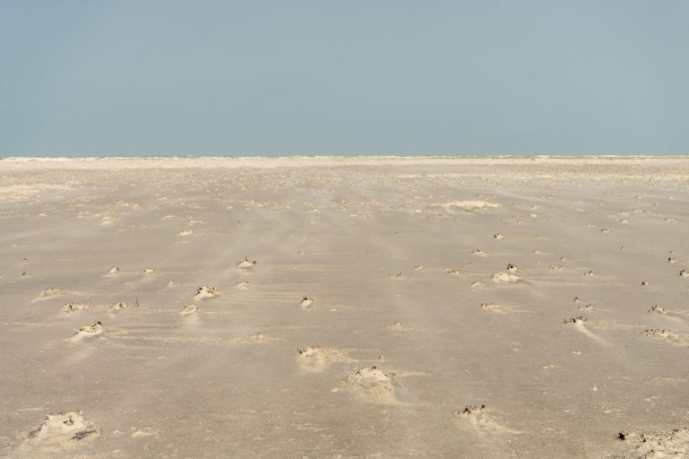
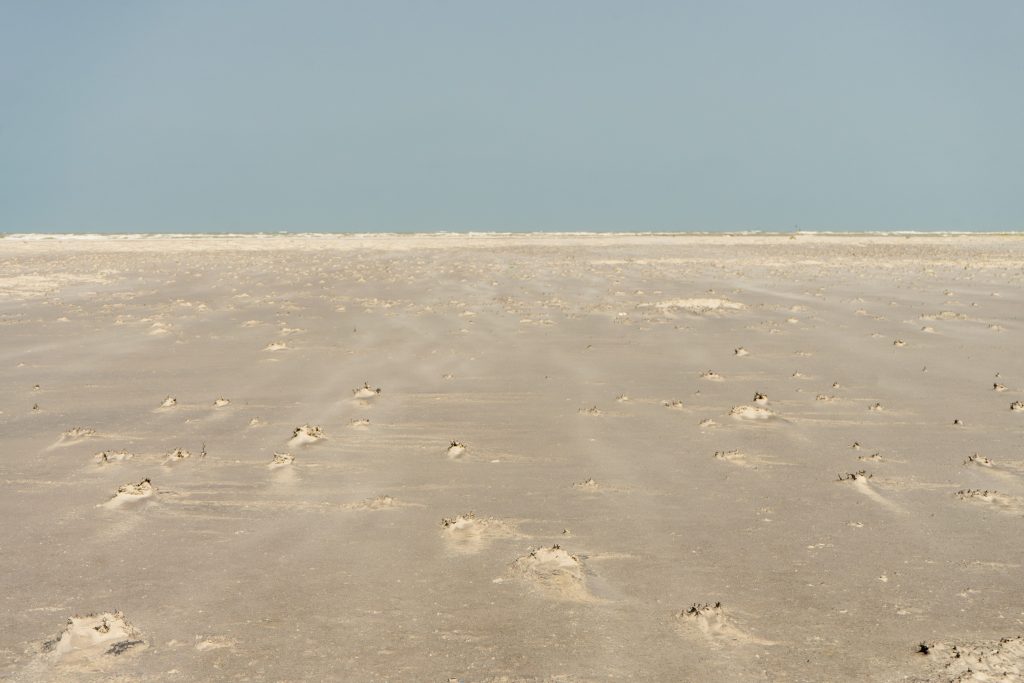
Sixteen sandbanks make up the chain, and the maritime boundary runs down the middle, so eight belong to Sri Lanka and eight to India. They are known locally as the “dancing islands”, because the sand is constantly moved about by the sea and their shapes change. Writing in the Sunday Times after a trip in 2011, Nimal Chandrasena described the second island as dry sand with almost no plants, covered in the tracks of crabs and worms, with seagulls overhead and patches of black, mineral-rich sand that stuck to his feet.
Rama’s Bridge or Adam’s Bridge?
The two names come from two different stories. In the Ramayana, the Hindu epic, Rama’s army builds the bridge to cross to Lanka and rescue Sita from Ravana, which is why it is also known as Rama Setu, or Ramar Palam in Tamil. The name Adam’s Bridge comes from an Islamic tradition that Adam crossed here on his way to the mountain now known as Sri Pada, or Adam’s Peak. For many visitors, the place matters more for these stories than for the view.
A marine national park
The Sri Lankan section of Adam’s Bridge became a national park on 22 June 2015, and the Department of Wildlife Conservation describes it as the country’s first marine national park. The Indian section is part of India’s Gulf of Mannar Marine National Park. Under the Department’s rules, visitors may enter a marine national park to observe and study its plants and animals, while activities that were carried on by custom or tradition before the park was declared, such as local fishing, can continue under conditions.
The shallow water and sand matter for wildlife. Many migratory birds use the route between Pamban Island, Adam’s Bridge and Mannar Island on their way to and from Sri Lanka, and birds such as the brown noddy breed on the sandbanks. Fish and seagrass thrive in the shallows, and dolphins, dugongs and turtles live in the surrounding sea. Seeing a dugong is far from guaranteed, though, so think of any sighting as a bonus.
On the sandbanks, keep away from nesting birds and take all your rubbish back to the mainland. Drones are a bad idea in a border area full of birds, so read our guide to Sri Lanka’s drone rules before you even unpack one.
Seeing it from Talaimannar
Talaimannar, at the north-western end of Mannar Island, is as close as you can get by road. The shore here is flat, open sand facing the sea, and on most days the sandbanks are, at best, a faint line on the horizon. The old pier is in a Navy-controlled area, so respect any signs and barriers, and don’t photograph Navy buildings or boats. Our guide to Mannar Island covers the pier, the lighthouse and the end of the railway line nearby.
Don’t try to wade or swim out to the sandbanks. These are patrolled border waters, the channels between the banks are open sea, and the Indian half of the chain is Indian territory.
Boat trips to the sandbanks
Getting onto the sandbanks themselves means a boat from the Talaimannar shore. The Sri Lanka Navy began running a boat service for visitors in April 2011, taking them out to the second sandbank, with life jackets provided and a second boat as escort. Two Sunday Times writers who made the trip describe a fast, bumpy ride (one timed it at about 25 minutes each way), and both came back wet through, so put your camera and phone in a dry bag.
Who runs the trips, what they cost and whether foreign visitors can join have changed over the years, and trips only go when the sea allows. See the travel update at the top of this page, and ask in Mannar town before you drive out to Talaimannar.
Getting there
The A14 runs the length of Mannar Island, from Mannar town to Talaimannar, and the Mannar railway line ends at Talaimannar. Mannar town is the easiest base, and from there a tuk-tuk or car will take you out to the north-western end of the island. This flat coast has little shade and gets very hot in the middle of the day, so bring water and a hat. For trains and drivers, see our guide to getting around Sri Lanka, and if you are heading on to Jaffna, our 7-day northern itinerary shows how Mannar fits in.
Frequently asked questions (FAQs)
Can you walk from Sri Lanka to India across Adam’s Bridge?
No. The sandbanks are separated by stretches of open sea, and the maritime border between Sri Lanka and India runs through the middle of the chain. These are patrolled border waters, so don’t try to wade or swim out.
Can you visit the Adam’s Bridge sandbanks?
Yes, by boat from the Talaimannar shore, when trips are running and the sea is calm enough. Arrangements change, so check the travel update at the top of this page and ask in Mannar town first.
Where can you see Adam’s Bridge from in Sri Lanka?
From the shore at Talaimannar, at the north-western end of Mannar Island. On most days the sandbanks are, at best, a faint line on the horizon.
Is Adam’s Bridge a national park?
Yes. The Sri Lankan section became a national park on 22 June 2015, and the Department of Wildlife Conservation describes it as the country’s first marine national park.
Why is it called Adam’s Bridge?
The name comes from an Islamic tradition that Adam crossed here on his way to Adam’s Peak. In the Ramayana, Rama’s army builds it, which is why it is also called Rama’s Bridge or Rama Setu.
Sources: dwc.gov.lk, lk.chm-cbd.net, tourismnorth.lk, en.wikipedia.org (Adams Bridge), en.wikipedia.org (Adams Bridge Marine National Park), sundaytimes.lk (wild north gets govts helping…), sundaytimes.lk (will conservation boom in the…), sundaytimes.lk (plus 05.html), sundaytimes.lk (adams bridgestepping stone to untapped…), sundaytimes.lk (un sec gen surprises herath…), slguardian.org, en.wikipedia.org (Mannar line) and recent visitor reports. Header photo: CarneDiem / Wikimedia Commons, CC BY-SA 4.0.