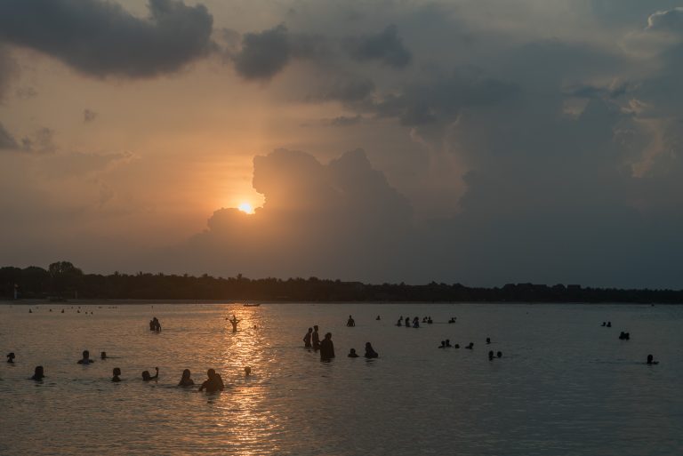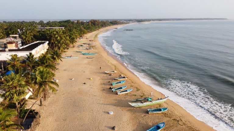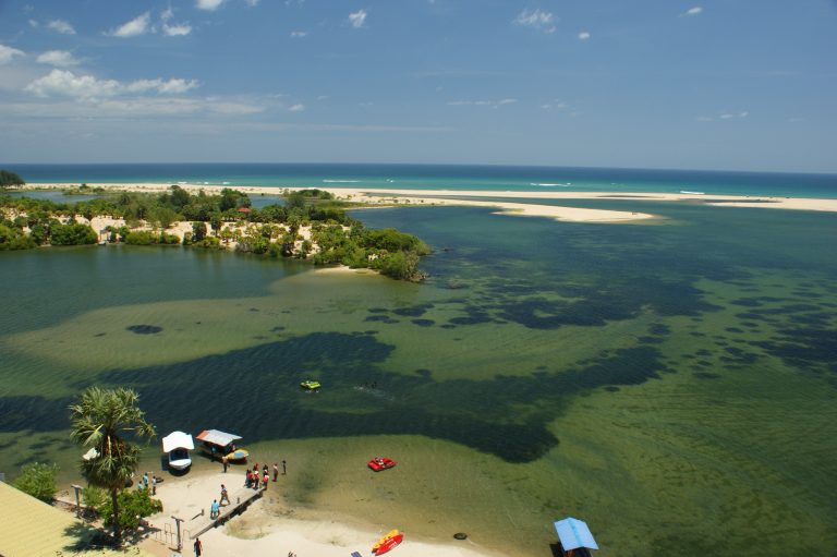
Batticaloa is the main city of Sri Lanka’s east coast between Trincomalee and Arugam Bay, built on a narrow strip of land and islands between the Indian Ocean and the long Batticaloa Lagoon. It is a working city rather than a resort, and its sights are low-key: a Portuguese-built fort on the water, an old iron bridge tied to the legend of the “singing fish”, a long town beach and a lighthouse where the lagoon meets the sea.
Is Batticaloa for you?
Go if you like places that run at their own pace, with lagoon views, colonial history and very few other tourists. It is an easy stop on the train line from Colombo and a good base for the beaches at Pasikuda and Kalkudah to the north-west.
Think twice if you want nightlife, a resort strip or a full day of big-name sights. Recent visitors (2025–26) describe the city as conservative and quiet after dark, and you can see the main sights in a day.
The lagoon and the singing fish
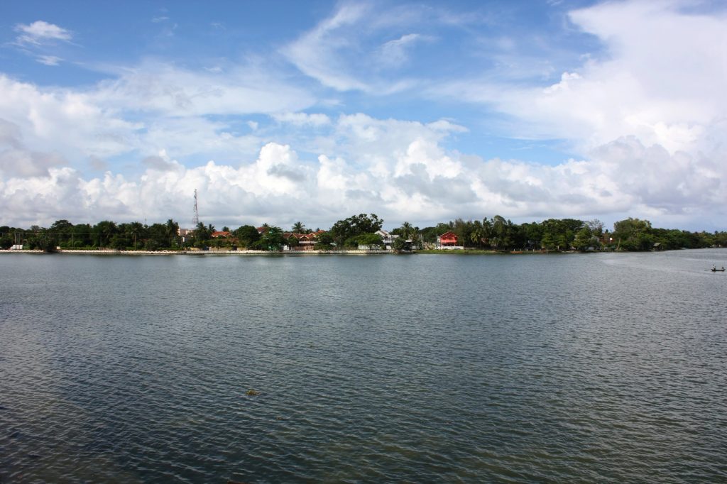
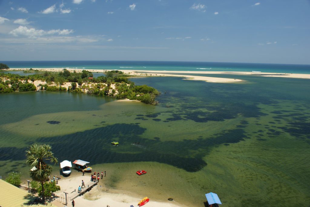
The Batticaloa Lagoon runs for many kilometres along the coast, fed by small rivers and fringed with mangroves that draw a wide variety of water birds. The city spreads over its shores and islands, joined by a string of bridges, so you are rarely far from the water.
Batticaloa calls itself the land of the singing fish. Sri Lanka Tourism says that on full-moon nights from April to September a faint musical sound, like a plucked guitar string, rises from the lagoon near Kallady Bridge, and that locals listen by putting one end of an oar in the water and the other to their ear. According to local accounts, priests from St Michael’s College recorded the sound under the bridge, and the recording was broadcast on Radio Ceylon in the 1960s. Nobody has settled what makes it, and there is no guarantee you will hear anything, but a full-moon evening on the bridge is a good excuse to be out on the water.
Kallady Bridge and Kallady beach
The old iron Kallady Bridge, built under British rule and also known as the Lady Manning Bridge, carries the main road into the city from the south across the lagoon. A newer road bridge now takes the traffic alongside it, so the old one is a pleasant place to walk, watch the fishermen and catch the evening light.
Beyond the bridge, Kallady beach is the city’s long stretch of sand facing the open sea. Recent visitors report a local scene rather than a tourist one: fishermen, families and cricket matches in the evening. The beach is open ocean, not a sheltered bay like Pasikuda, so only swim when the sea is calm and follow any local warnings.
Batticaloa Fort
The fort was built by the Portuguese in 1628 and captured by the Dutch in 1638, and was later held by the British. It stands on a small island with the lagoon on two sides, and its low stone walls and bastions are easiest to appreciate from the water or the opposite shore.
For most of its modern life the fort housed government offices. The government agent’s office moved out in June 2024, and the government has said it plans to develop the fort for tourism. Recent visitors report that you can walk in and look around the walls for free during the day, though parts may be closed off.
Batticaloa Lighthouse
North of the centre at Palameenmadu, where one of the lagoon’s two openings meets the sea, the tall white lighthouse stands among palms and scrub. The lagoon mouth beside it is shallow and sandy.
A city that has been through a lot
Batticaloa’s recent history has been hard. The civil war cut the railway between Polonnaruwa and Batticaloa from 1996 to 2003; the 2004 Indian Ocean tsunami made it one of the worst-hit places in Sri Lanka; and on Easter Sunday 2019 a suicide bomber attacked Zion Church, one of the attacks on churches and hotels across the country that day. Since the war ended in 2009 the city has rebuilt, and it is now a regular stop for travellers on the east coast. If the subject comes up, let local people lead the conversation.
When to go
The east coast is driest from about May to September, while the south-west monsoon brings its rain to the other side of the island. October and November are rainy across the whole country, and the north-east monsoon brings heavy rain to the east coast from December to February. March to May is the hottest time of year.
Getting there
By train: Batticaloa is the end of the Batticaloa line, which runs from Colombo Fort via Polonnaruwa. Services were suspended after Cyclone Ditwah in late 2025 and returned in early 2026: the Pulathisi Intercity on 20 January and the Meenagaya night train on 23 February. Reserved seats are sold on the Sri Lanka Railways seat reservation site.
By road: the A4 from Colombo ends at Batticaloa after running through Ratnapura, Wellawaya, Pottuvil and Kalmunai, so it links the city with Arugam Bay to the south. From the Cultural Triangle, the road from Habarana runs via Polonnaruwa.
Frequently asked questions (FAQs)
Is Batticaloa worth visiting?
Yes, if you enjoy quiet cities, lagoon scenery and colonial history: the fort, Kallady Bridge, Kallady beach and the lighthouse fill a relaxed day. It is not a resort town.
What are the singing fish of Batticaloa?
A local legend: on full-moon nights from April to September, a faint musical sound is said to rise from the lagoon near Kallady Bridge. A recording of it was broadcast on Radio Ceylon in the 1960s, but what makes it has never been settled.
Can you visit Batticaloa Fort?
Recent visitors report that you can walk in and look around for free during the day, though some parts may be closed off. The government agent’s office moved out in 2024, and the government plans to develop the fort for tourism.
How do you get to Batticaloa from Colombo?
By train on the Batticaloa line from Colombo Fort via Polonnaruwa, or by road on the A4. Train services resumed in early 2026 after Cyclone Ditwah.
When is the best time to visit Batticaloa?
From about May to September, the driest part of the year on the east coast. The heaviest rain falls from October to February.
Sources: srilanka.travel, en.wikipedia.org (Batticaloa), en.wikipedia.org (Batticaloa Lagoon), en.wikipedia.org (Kallady Bridge), en.wikipedia.org (Batticaloa fort), sundaytimes.lk (batticaloa fort to be developed…), sundaytimes.lk (absorbing journey through batticaloa 381420.html), en.wikipedia.org (Batticaloa Lighthouse), en.wikipedia.org (Batticaloa line), gov.uk, sundaytimes.lk (batticaloa village in struggle to…), statistics.gov.lk, newswire.lk (train services to east restored…), dailymirror.lk, newswire.lk (meenagaya intercity express resumes services…), seatreservation.railway.gov.lk, en.wikipedia.org (A4 road (Sri Lanka)), en.wikipedia.org (Pasikudah) and recent visitor reports. Header photo: Anton Croos / Wikimedia Commons, CC BY-SA 4.0.