
Check before you travel Riverston road: light vehicles only Checked 5 October 2026
After Cyclone Ditwah, Riverston reopened to visitors on 1 February 2026 with light vehicles only: the Matale District Secretary banned heavy vehicles and large buses on the road, except public buses. On 5 July 2026 the Disaster Management Centre said the restriction still applied. Ask your driver or check local news before you go, especially after heavy rain.
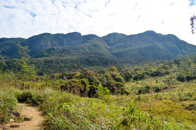
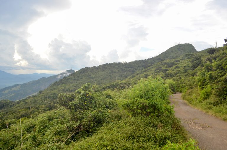
Riverston is a windswept ridge on the Matale side of the Knuckles range, where a narrow mountain road from Rattota tops out among transmission towers and grassland. A short walk from the road takes you to its summit viewpoint, and a few kilometres further on, Pitawala Pathana ends at a cliff edge known as Mini World’s End. Together they make one of the easiest ways to stand on the edge of the Knuckles Conservation Forest without committing to a trek.
Is it worth visiting?
Go if you want big views, cool wind and two short walks you can manage without a guide on a clear day, and you are happy with a slow, winding drive from Matale to get them.
Think twice if you can only come in the afternoon or in wet weather, because mist regularly rolls over the ridge and can leave you staring into white cloud after a long drive.
Riverston peak and the wind gap
The walk to the top starts where a paved side road leaves the main road and climbs to the towers on the summit. Central Province tourism puts the peak at 1,424 m and the walk at about 2 km, and says it is paved the whole way, so you don’t need hiking boots. Allow 15 to 20 minutes if you are fit, or up to 45 minutes at a gentler pace. There are short cuts through the scrub, but the province advises sticking to the road.
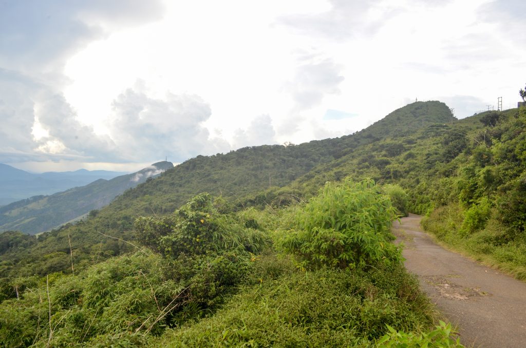
Riverston is known above all for its wind. Just below the summit, the gap the locals call Hulan Kapolla funnels gusts strong enough to make you lean into them, and Central Province tourism warns they can feel as if they will carry you away. Keep hats, drones and small children firmly in hand. From the top, the land falls away to the north towards Illukkumbura and the lower hills and valleys of the dry zone.
Because the ridge sits close to the dry zone, it is usually milder than the higher parts of the Knuckles. In the rainy season, though, mist and wind can turn it cold within minutes, so bring a layer even if Matale was hot when you left.
Pitawala Pathana and Mini World’s End
A few kilometres beyond the Riverston turn-off, beside the Rattota–Illukkumbura road, the forest opens out into Pitawala Pathana. A pathana is a patch of natural montane grassland, and this one is unusual: short, dense turf about 10 cm high growing on a thin layer of soil over a gently sloping slab of rock. Seen from the road it looks almost like a lawn, dotted with stunted trees and shrubs. Wikipedia and Central Province tourism both note the many endemic species here, so stay on the path.

A marked nature trail of about three-quarters of a kilometre crosses the grassland to Mini World’s End, an escarpment where the plateau stops abruptly and the view opens over the Knuckles peaks and the valleys below. Central Province tourism puts the drop at about 300 m. The trail itself is easy, but from the end you can walk out on the rock right up to the edge, and the rock is slippery when wet. Stay well back, especially in mist or wind, when the edge is hard to judge.
Don’t confuse this Mini World’s End with the one at Deanston on the Kandy side of the range, which is a separate walk. If you arrange a driver, say Pitawala to be sure.
Tickets and guides
Both walks are inside the Knuckles Conservation Forest, which is managed by the Forest Department. Recent visitors report a ticket counter beside the car park at Pitawala Pathana, but the prices they quote vary widely and we found no official fee list online, so carry cash. Central Province tourism recommends going with a guide at Pitawala. In clear weather the trail is obvious, but a local guide is worth having if you want to go further into the forest.
Recent visitors also say there is little to buy once you leave Rattota: no fuel, few shops and patchy phone signal. Bring water and snacks, and download an offline map before you set off.
When to go
Go early. Central Province tourism notes that mist covers this part of the range much of the time, and across the Knuckles cloud tends to build as the day goes on, so the first hours after sunrise give you the best chance of a view from both the peak and the cliff edge. After heavy rain the roads and trails are muddier, and leeches are common on forest paths throughout the Knuckles. Our health guide has tips on dealing with them.
Getting there
Riverston is reached from Matale by the road that climbs through Rattota towards Illukkumbura. Central Province tourism puts the start of the Riverston walk about 30 km from Matale and Pitawala Pathana about 3 km further on. The road is narrow, steep and full of hairpins, so allow plenty of time and avoid driving it after dark. A second road comes up from the Laggala side.
Cyclone Ditwah damaged these roads in late 2025, and there are vehicle restrictions on the Riverston road; see the travel update at the top of this page before you go.
Most visitors come by car or tuk-tuk from Matale or Kandy. Our guide to getting around Sri Lanka explains how to hire a driver. From Kandy it makes a full day out; from Matale, a morning.
Frequently asked questions (FAQs)
How high is Riverston?
Central Province tourism gives the peak’s height as 1,424 m. The walk to the summit follows a paved road of about 2 km.
How long does the Riverston walk take?
About 15 to 20 minutes up if you are fit, or up to 45 minutes at a slower pace, according to Central Province tourism.
What is Pitawala Pathana?
A natural montane grassland in the Knuckles Conservation Forest, with short turf growing on a thin layer of soil over sloping rock. A trail of about three-quarters of a kilometre leads across it to Mini World’s End.
Do I need a guide for Pitawala Pathana?
The trail is easy to follow in clear weather, but Central Province tourism recommends a guide, and one is useful if you want to walk further into the forest.
What is the best time of day to visit Riverston?
Early morning. Mist covers the ridge much of the time, and cloud tends to build later in the day.
Sources: tourism.cp.gov.lk (riverston peak), tourism.cp.gov.lk (pitawala pathana), tourism.cp.gov.lk (hiking n trekking), en.wikipedia.org (Pitawala Pathana), en.wikipedia.org (Knuckles Mountain Range), whc.unesco.org, dailymirror.lk (Riverston reopens to tourists under…), dailymirror.lk (Riverston in Knuckles reopens to tourists), dailymirror.lk (Road access restricted in Riverston…) and recent visitor reports. Header photo: Aldshakya / Wikimedia Commons, CC BY-SA 4.0.