Check before you travel Hatton roads: earth-slip risk in heavy rain Checked 10 October 2026
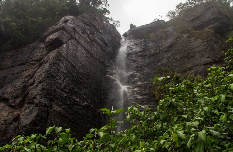
On 24 September 2026 an earth slip blocked the Hatton–Colombo road at Kuyilwatte for several hours, and Hatton Police urged motorists to take care on the Hatton–Nuwara Eliya and Hatton–Colombo roads and nearby routes because of the continuing risk of earth slips. This stretch also leads to St Clair’s Falls and Devon Falls. After heavy rain, check local news and heed police and Disaster Management Centre warnings before you drive.
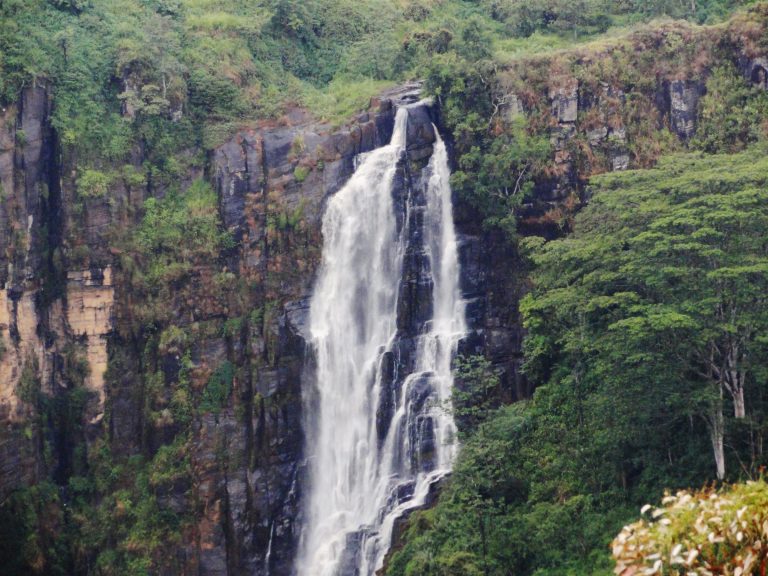
Devon Falls drops about 97 m in three steps into a tea-covered valley, roughly 6 km west of Talawakele on the A7 between Hatton and Nuwara Eliya. You see it from a viewpoint beside the road, with a tea centre across the way, which makes it an easy stop on the drive up to Nuwara Eliya.
Is it worth visiting?
Go if you are already on this road and want a short stop with a good view and a cup of tea. The fall is tall and narrow, and it frames well against the tea slopes behind.
Think twice if you want a waterfall to walk to or swim in. Guides report no access to the base, and the stop is brief. Pairing it with St Clair’s Falls, a few minutes along the same road, makes the pause more worthwhile.
What you will see
The water comes off a tributary of the Kotmale Oya and falls in three drops, according to Wikipedia, which also gives it the nickname “Veil of the Valley”. Wikipedia and Sri Lankan visitor guides give the height as about 97 m. Sources disagree on where it ranks among the island’s waterfalls, so we leave that out.

From the viewpoints you look across a gorge to the fall, with a village and tea terraces on the far ridge. Guides suggest early morning, when mist can sit in the valley and the light is softer.

Viewpoints and the tea centre
Travel guides list two observation points on the A7 and say the lower one gives the better view. The Mlesna tea centre stands on the highway close by, and guides describe it as the usual rest stop for road trips to and from Nuwara Eliya. They also say there is no direct access to the foot of the falls, and one says the land is private. Stay at the viewpoints.
Flow and the best season
Like St Clair’s, Devon Falls is described as affected by the Upper Kotmale Hydropower Project, and we found no official flow information. Guides give different best months (June to August in one, December to March in another), so the safest rule is that heavy rain in the hills makes a fuller fall and dry weeks make a thinner one.
Getting there and staying safe
Devon Falls is on the A7, about 6 km west of Talawakele, so it sits on the normal route for any car, taxi or driver heading from Hatton to Nuwara Eliya. Allow 15 to 30 minutes.
The road has had landslides after heavy rain. See the travel update at the top of this page, and check the weather and local warnings before you go, and park only in the marked spaces rather than on the carriageway.
Around Devon Falls
- Next stop: Nuwara Eliya is the main town of the hill country.
- Tea: Pedro Tea Estate offers factory visits.
- Another waterfall: Lover’s Leap Falls, on the edge of Nuwara Eliya.
- Coming from the west: Hatton and Dickoya is the last big stop before the falls.
Frequently asked questions (FAQs)
Where is Devon Falls?
On the A7 highway, about 6 km west of Talawakele in Nuwara Eliya District, between Hatton and Nuwara Eliya.
How high is Devon Falls?
About 97 m, falling in three drops, according to Wikipedia and visitor guides.
Can you walk to the bottom of Devon Falls?
Guides report no direct access to the base, and one says the land is private. You see the falls from the viewpoints on the A7.
Is there an entrance fee?
We found no official fee or opening hours. The viewpoints are beside the road.
What is the best time to see Devon Falls?
Sources disagree on months. After heavy rain the falls are fuller, and an early morning usually gives a clearer view than a misty afternoon.
Header photo: Rehman Abubakr / Wikimedia Commons, CC BY-SA 4.0.