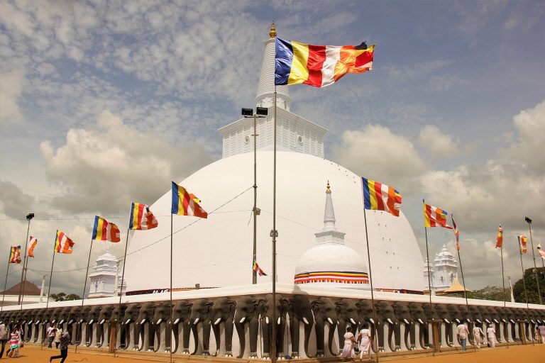

Sri Lanka packs more than two thousand years of history into an island you can cross in a day, and most of it is still standing somewhere you can visit. The stupas of Anuradhapura, the Dutch ramparts of Galle and the tea estates of the hill country are chapters of the same story. This is that story in brief, told through the places where you can see it, with links to our guides for each one.
The first kingdoms: Anuradhapura
The early written history of the island comes from Buddhist chronicles, and it centres on Anuradhapura, in the dry plains of the north-centre. According to UNESCO, the city grew up around a cutting of the Buddha’s fig tree, brought here in the 3rd century BC, and it was a political and religious capital for about 1,300 years.
What survives is on a vast scale: brick stupas as tall as hills, monasteries and the great reservoirs, or tanks, that its kings built to store water through the dry season. Those tanks are the reason the dry zone could feed a capital at all, and many still hold water today. See the Sacred City of Anuradhapura, Ruwanwelisaya and Jetavanaramaya; the Central Cultural Fund counts the great stupas of Anuradhapura among the tallest brick structures of the ancient world.

Polonnaruwa, Sigiriya and the moving capital
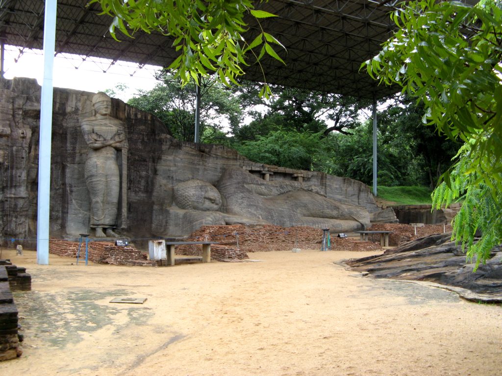
Invasions from South India brought Anuradhapura down. The Chola emperor Rajaraja I sent an army in 993, and by 1017 most of the island had become a province of the Chola empire. Prince Kitti, later King Vijayabahu I, drove the Cholas out in 1070, and the capital moved south-east to Polonnaruwa. Its high point came under Parakramabahu I in the 12th century, the king behind the garden city and the great reservoir you can walk along today. See the Ancient City of Polonnaruwa and Gal Vihara.
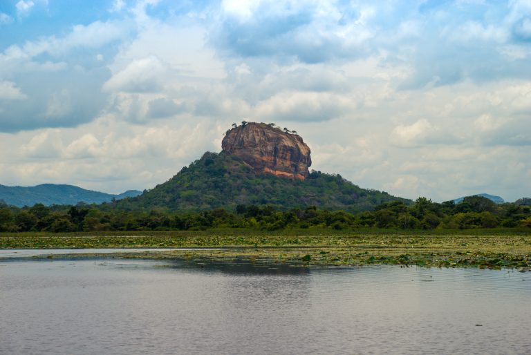
Sigiriya belongs to an earlier, shorter story. In the late 5th century, King Kassapa I built his capital on and around the rock, according to UNESCO, and after his death the site became a monastery. See Sigiriya rock fortress.
After Polonnaruwa declined in the 13th century, the Sinhala capital kept moving: to Dambadeniya, Yapahuwa, Gampola and Kotte, near today’s Colombo. Two of those stops are worth a detour: the Dambadeniya historic site and the rock fortress of Yapahuwa. Meanwhile, in the north, a Tamil kingdom ruled from Jaffna from 1215 until 1619.
Kandy, the last kingdom
From the late 16th century the hill kingdom of Kandy was the only independent Sinhala kingdom left, and it held out against three European powers for more than two centuries. Its kings kept the tooth relic of the Buddha, and the Temple of the Sacred Tooth Relic beside Kandy Lake is still the heart of the city. UNESCO lists Kandy as the last capital of the Sinhala kings. See Kandy.
Portuguese, Dutch and British
European rule came from the sea, and for a long time it stopped at the coast.
- The Portuguese reached the island in 1505, drawn by the cinnamon trade, and came to control much of the coast.
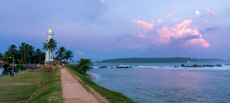
- The Dutch East India Company took the coastal territories from them between 1640 and 1658 and held them until 1796. Galle Fort, which UNESCO calls the best example of a fortified city built by Europeans in South and South-East Asia, is largely their work. So are Matara’s Star Fort and the Old Dutch Hospital in Colombo.
- The British took the Dutch territories from 1796. In 1815, through the Kandyan Convention signed on 2 March, they took Kandy as well, and the whole island came under one colonial government for the first time.

The British changed the landscape more than anyone before them. Forests in the hills were cleared, first for coffee and then for tea. James Taylor, a Scottish planter at Loolecondera estate, helped develop the tea industry there; today that estate is part of the group of tea sites Sri Lanka has put forward for UNESCO listing. The first railway ran from Colombo to Ambepussa in December 1864, and it was coffee planters who had first pressed for a line from Kandy to Colombo to move their crops. That is the line the famous hill-country train still runs on. See the Ceylon Tea Museum and our train travel guide.
Independence and a new name
Ceylon became independent in 1948 as a dominion of the British Empire, and Independence Square in Colombo marks the event. On 22 May 1972 the country became a republic and took the name Sri Lanka.
Civil war, tsunami and recovery
From 1983 the government fought a long civil war against the Liberation Tigers of Tamil Eelam (LTTE), who sought a separate Tamil state in the north and east. The war began in July 1983 and ended on 18 May 2009 with the LTTE’s defeat. It cost many lives, displaced large numbers of people and left deep scars, especially in the north and east, and the events of its final months are still the subject of debate. For travellers, its end reopened the north and east: Jaffna, Trincomalee and the east coast now see visitors again.
In December 2004 the Indian Ocean tsunami struck the island’s east and south coasts with great loss of life. More recently, a severe economic crisis in 2022 brought months of mass protests, known as the Aragalaya (“struggle”), and the president resigned in July that year. In November 2025, Cyclone Ditwah caused floods and landslides that damaged the hill-country railway, which is still being repaired.
Where to see it
- The early kingdoms: Anuradhapura, Polonnaruwa, Sigiriya and the cave temple at Dambulla; our guide to Sri Lanka’s UNESCO World Heritage Sites shows how they fit together.
- The north: Jaffna, with its Dutch-era Jaffna Fort and Nallur Kandaswamy Temple.
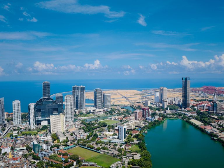
- The colonial coast: Galle Fort, Matara and Colombo’s Fort district.
- The British hill country: the tea estates and the railway around Nuwara Eliya, Haputale and Ella.
- The whole story in one building: the Colombo National Museum.
Frequently asked questions (FAQs)
What were the ancient capitals of Sri Lanka?
Anuradhapura was the first great capital, for about 1,300 years, followed by Polonnaruwa from the late 11th century. The capital then moved several times, through Dambadeniya, Yapahuwa, Gampola and Kotte, before Kandy became the last Sinhala kingdom.
Which European powers ruled Sri Lanka?
The Portuguese from 1505, the Dutch from 1640 to 1796 and the British from 1796. Only the British took the hill kingdom of Kandy, in 1815.
When did Sri Lanka become independent?
In 1948, as the Dominion of Ceylon. It became a republic and took the name Sri Lanka on 22 May 1972.
When did the civil war in Sri Lanka end?
On 18 May 2009, when government forces defeated the LTTE. The war had begun in July 1983.
Why was Sri Lanka called Ceylon?
Ceylon was the name used under British rule and kept after independence in 1948. The country took the name Sri Lanka when it became a republic in 1972.
Header photo: Michael Gunther / Wikimedia Commons, CC BY-SA 4.0.